 |
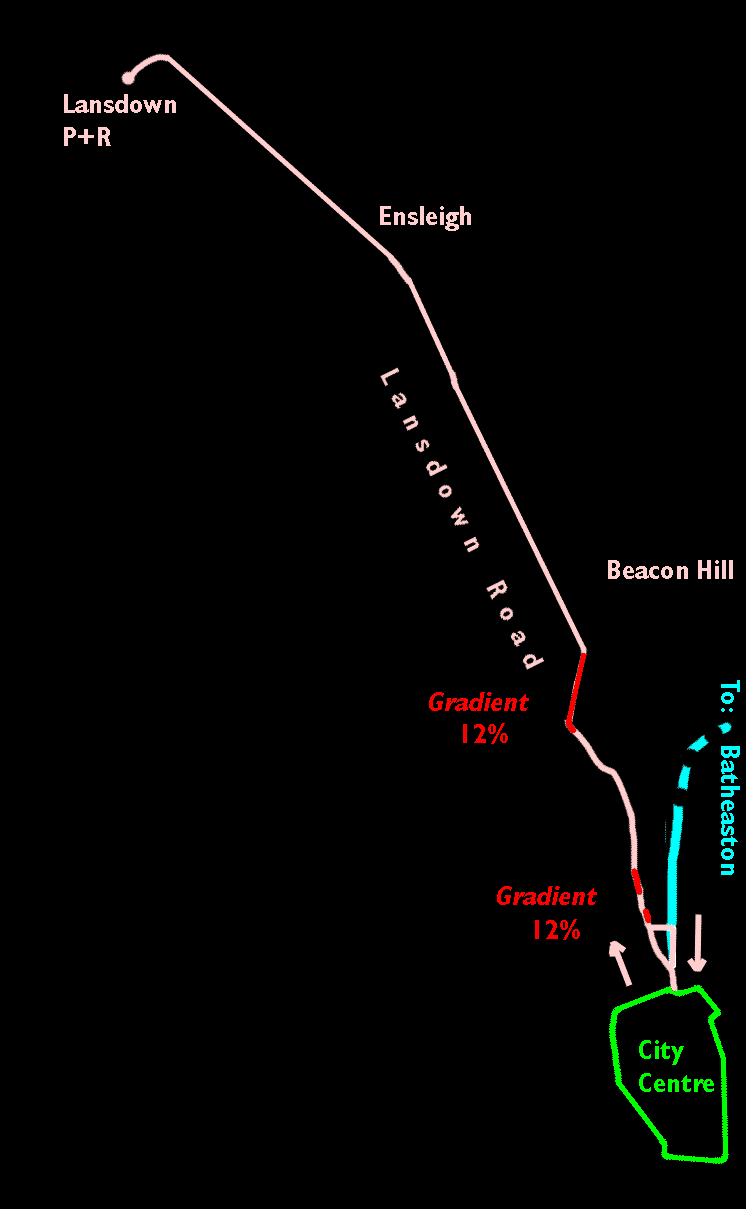
The Lansdown Route and the Batheaston route both leave the City Centre Circle at the junction of Northgate Street and Upper Borough Walls and proceed up Broad Street. At Saracen Street, the Batheaston route turns right but the Lansdown route climbs to the top of Broad Street, crosses the junction of George Street with The Paragon and continues into Landown Road. It follows Lansdown Road to the Park+Ride site on Lansdown. The return route from Lansdown Road comes down Broad Street in contra-flow to all other traffic and turns left into Saracen Street, joining the Batheaston route and returning to the City Centr Circle through Northgate Street. Because of the contra-flow, special traffic control measures will have to be implemented in Broad Street. This route is particularly hilly and includes three sections of 12% (1 in 8) gradient, one at the top of Broad Street, one at the lowest point of Lansdown Road and one outside the 'Lansdown Grove'. Trams operated on the 12% Broad Street gradient from 1904 to 1939 without serious accident and it should be possible to use modern vehicles on similar gradients without problems. A loop track around the P+R site would enable vehicles on this route to use bicycle trailers. Click here to see why this is necessary. |